Walking the Dartmoor Fringe: Pullabrook to Lustleigh

Image of Higher Knowle Wood
This short walk (3.3 miles) starts and ends at the Pullabrook Wood carpark (SX789801 on the OS map). The walk follows minor roads and footpaths and does include some modest gradients over some fairly rough paths, so appropriate footwear is essential.

Getting there!

The starting point for this walk is the small car park at Pullabrook Woods.  The car park is not marked on the 1:25000 OS map, but it is marked as Bovey Valley Woods – Pullabrook Car Park on Google Maps.  If you click on the marker, you can get directions to it.  Alternatively, you can go to the Google Map at the bottom of this post and click on ‘Directions From Bovey Tracey’ to see the directions.  The map will also show you where the images were taken.

If you don’t like Google Maps, just make a note of the following directions.

  1. Take the Manaton Road from Bovey Tracey.
  2. Turn Right at Reddaford Waster Cross – just before the entrance to Yarner Woods. Signposted Lustleigh
  3. Follow the (sometimes very narrow) road down to the bottom of the hill.
  4. Turn Left into the car park. 

Be aware that the car park is quite small and can be crowded at busy times.  Also, be sure not to obstruct the throughway; large vehicles working in the woodland often need access.

As this is a circular walk you can, of course, start the walk at any point.  However, the only other place you can park with any safety is in Lustleigh.  However, finding somewhere safe and non-obstructive to park can often prove difficult.

Where to go and what to look out for.

Map of route

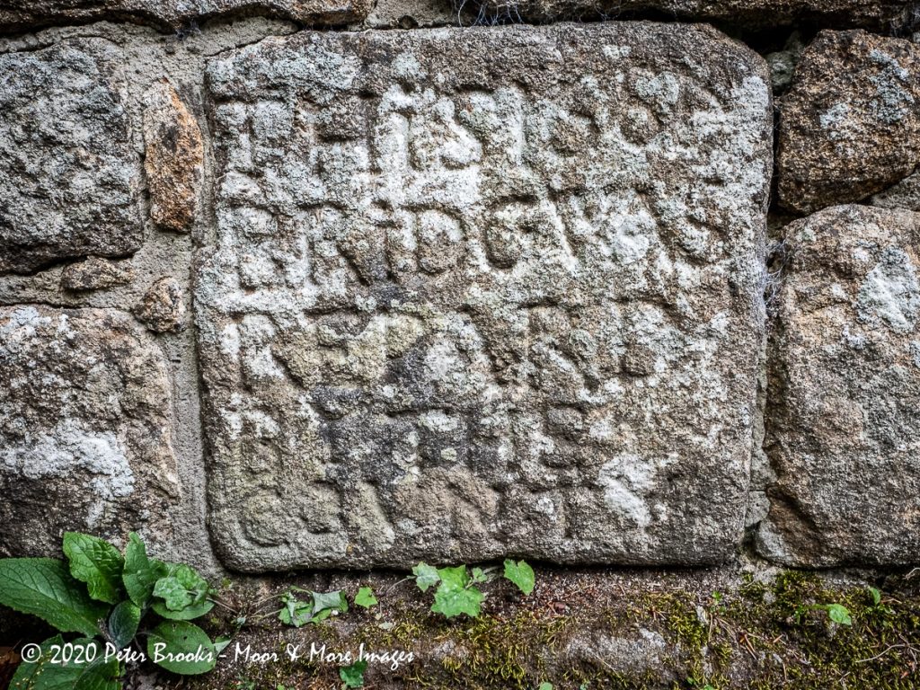
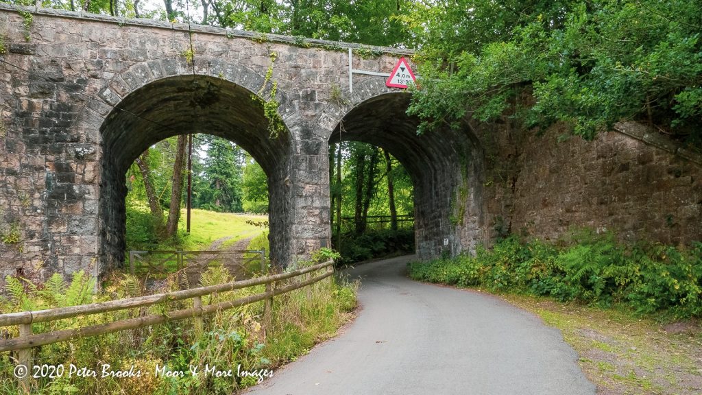
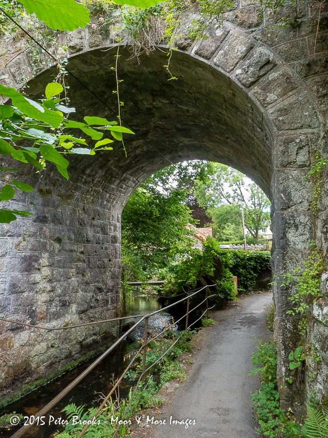
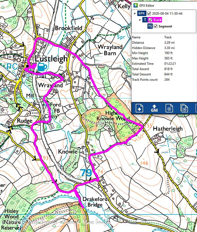
Walk back out of the car park to the road you just came down and turn left.  In a very short distance, you will come to Drakeford Bridge. According to Historic England ‘this Bridge over (the) river Bovey, 1684 or earlier, was widened 1809 by James Green, county surveyor‘.

If you pause in the centre of the bridge you will see on the right-hand side an engraved plaque that reads:- 

THiS 1684 (the 4 is reversed) BRiDG WAS REPARD BY THE COUNTY

Follow the road keeping right at a junction and pass Ivy Cottage on your right.  Shortly after, you will pass over another bridge that is referred to on the old OS maps as ‘Packhorse Bridge’.  Ahead you will see a railway bridge.  On this walk, you will pass under and over what was the Moretonhampstead Branch of the GWR line.  A victim of Dr Beeching, the line from Bovery Tracey has now been repurposed as the ‘Wray Trail’ cycle path for quite a bit of its route (but not this section). It is interesting that the bridge has two arches, one for the road and one connecting farmland on either side of the track.

A short walk uphill brings you to a ‘T’ junction.  The minor road that you are joining is Lower Knowle Road.  Until a couple of years ago this was a quiet backwater serving only the scattered houses and farms along its length.  Now, it is part of the ‘Wray Trail’ and in good weather can be quite busy.  Look  to your right as you join the road to see some lovely thatched cottages and a vibrant PO Box in the wall.

Turn Left at this T junction and follow the road. After 200m look for a stone gatepost by a drive entrance on your right. It looks like a private drive but once you round the corner you can see the fingerpost pointing your way up ‘Robin Hill’.  This is a lovely, (although rough at times) sunken path with mature trees and rock outcrops on either side.

Image of path going uphill through woodland
Image of rocks in woodland
Image of woodland

Robin Hill links Lower Knowle Road and Hatherleigh Lane.  At the top of the path, there are great views to the East and South West.  On your left is the entrance to Higher Knowle Wood.  This Ancient, Semi-Natural Woodland is managed by the Woodland Trust.  Follow the obvious path North along the ridge through mature trees.

After about 400m, at the Northern end of the ridge you will find the path leading down to Lustleigh.

Image of country path
Image of Image of landscape near Lustleigh

You will enter Lustleigh at the corner of Lower Knowle Road and Brookfield Road.  There is a fine Victorian PO Box on the wall at the corner.  Go straight ahead.  After the row of cottages on your right, there is an entrance where the ‘Wray Trail’ cycle path rejoins the old branch line.  In fifty yards you cross a bridge over the branch line and down on your left is Lustleigh station; now a private residence.

image of larege stone in a wall

As you approach the next corner look for a large stone built into the wall on your right. (Note: this can often be obscured by parked cars).  This is the Bishop’s Stone’. It is believed to have been the base for an ancient stone cross.  However, no socket has been cut into the top. 

The derivation of its name is unclear, but one of the more plausible explanations is that it was named after Bishop Grandisson, a 14th Century Bishop of Exeter. He was supposed to have dined upon the stone whilst passing through the village (he would have needed to be tall and eaten standing up!). There are some very faint markings on one side of the stone which are thought to represent the Bishop’s coat of arms, but Tim Sandles questions this.        SEE LINK.  

Image of Lustleigh war memorial

Follow the road round to the left into Lustleigh, passing the war memorial with its wonky flagstaff!

As you come down the hill past the church look back up to your left to see The Church House.  According to British Listed Buildings Site:- It is a ‘Public hall, believed to have been the Church House originally. Probably C16, with C20 addition at rear’. 

Just down from the Church House is the pub! No visit to Lustleigh is really complete without a visit to ‘The Cleave’.!

Walk down the village past the village cross and keep left around Pound Cottages.  You will pass under the Moretonhampstead Branch line again.  This time the bridge serves a footpath and alongside it runs a leat that once served a corn mill.

Follow the path (Wreyland Path) keeping the cricket field on your left. Shortly, you will come into Wreyland with its wonderful thatched cottages.

As you pass ‘Lower Wreyland’ note the inscription over the door, that reads ‘REBUILDED 1842’.  A little further on is this wonderful doorway dated 1860. Together with pump and stone trough,

Image of cottage door

Continue along Wreyland Lane and look for the footpath on the right. It is just past a thatched house and there is a fingerpost by the wall of that house that you can’t see until you have gone past. Follow the path along the lane and down through a field to the stream.  The path winds down through a wooded area to a footbridge across the River Bovey.  Cross and follow the path.  This would be an idyllic spot if it were not for the sewage treatment works that the path now skirts!  Across the river from the path is the interesting Mill Bottom South.  Keep following the path and eventually, it will take you once more across the track of the Moretonhampstead Branch Line. (The bridge is no more).

Image of wooden footbridge

Once through this gap in the track, walk up to the road junction and turn left onto the byroad to Rudge.  Follow the road up the hill and turn left at the next junction.  The road will take you downhill to Ivy Cottage where you turn right to return to Pullbrook Wood car park.

You can see where most of these images were taken on the interactive map below.  Note that you can expand the map to full screen by clicking on the tab on the top right of the map.  Clicking on the tab on the top left allows you to access the menu bar and if you click on any of the images they open. A second click on the image in the sidebar opens it larger.

If you like the walk and would like to know when we add more walks, tick the add me to your mailing list below.  Don’t worry. we do not share our mailing list with anyone and we will only mail you when we have added a new post, or substantial new content, to our site.

Facebook
Twitter
LinkedIn
Pinterest

Leave a Reply

Your email address will not be published. Required fields are marked *

Translate »

We'd like to keep in touch

Please Subscribe

and we will let you know when we add new galleries or posts